

Drivers could end up stranded or delayed this week as freezing temperatures hit the UK – with National Highways issuing a “severe weather alert” for snow.
The travel warning covers northwest England on Tuesday and coincides with four days of Met Office warnings for snow and ice.
Temperatures 5-6C lower than normal are forecast, with sunshine for many today but nearly all of the UK struggling to get more than a couple of degrees above zero.
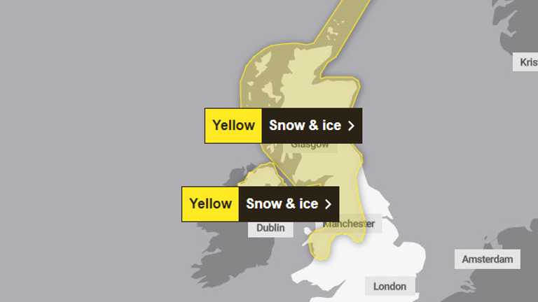
Monday’s snow and ice warning covers the whole of Northern Ireland and northern Scotland.
On Tuesday, the area expands to cover a large swathe of northern England, the whole of Scotland, and North Wales.
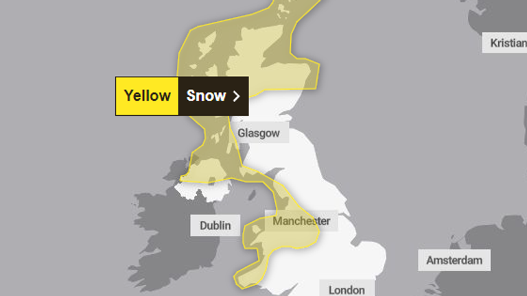
A snow warning continues on Wednesday and Thursday. Pic: Met Office
National Highways, which manages motorways and major roads, is urging drivers to “check ahead and plan for disruption” as “widespread snow” is expected in the North West.
It warns of potential delays and stranded vehicles – with 5-10cm possible on top of the A66 and M62 – and other parts getting between 1cm and 5cm.
Some rural communities could be cut off and rail services may also be delayed or cancelled, it adds.
Check the five-day forecast where you are
“We would recommend people stick to the main roads and avoid country lanes where possible,” says Met Office meteorologist Liam Eslick.
“These are the places that aren’t going to see any gritting or any road clearances for the next couple of days.
“So we recommend people take their time, make sure they have time to do their cars in the mornings, and go steady.”
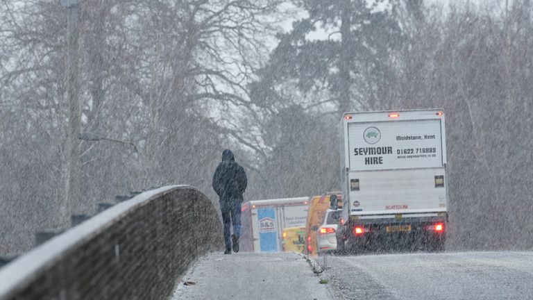
Drivers are being urged to stick to main roads if possible
Mr Eslick says the snow is down to a strong northerly wind bringing in an Arctic airmass.
A Met Office snow warning remains in force on Wednesday and Thursday, over a slightly smaller area but still covering millions in places such as Greater Manchester, Liverpool and Northern Ireland.
As well as possible road and rail problems, the forecaster says there could be power cuts in some places.
This week’s warnings follow snow in the South East last week, with places such as Kent getting several centimetres, and flooding from Storm Henk persisting in many other areas.


