

The level of destruction caused by a 7.8 magnitude earthquake in Turkey is strikingly clear in this series of before and after images.
The earthquake hit in the town of Pazarcik, Kahramanmaras province, in the early hours of Monday morning.
Residences, shops and places of worship collapsed as more earthquakes and aftershocks continued to rock the region.
Move the white bar left and right on the images below to see how badly places were affected.
Historic buildings such as the Roman-era Gaziantep Castle were badly damaged. It had previously been regarded as one of the best-preserved buildings of its kind in the country but now huge parts of the ancient structure have crumbled.
It is located in the city of Gaziantep which is only around 35 miles from the epicentre of the earthquake.
Hundreds killed and thousands injured – earthquake latest updates
Key infrastructre was also hit. Parts of the Hatay Antakya Academy Hospital near the Syrian border turned to rubble during the natural disaster.
Whole streets have been transformed into scenes of destruction.
Residential buildings and shops along this major road in Kahramanmaras were destroyed.
One modern hotel in Malatya collapsed while other buildings in the vicinty remained standing.
Nearly 3,000 people have died and thousands more have been injured across wide swaths of Turkey and neighboring Syria, with fears the number of casulaties will continue to rise.
The yellow line highlights some of the worst affected areas in southern Turkey and northwest Syria.
The epicentre was registered in the Turkish town of Pazarcik, near the city of Gaziantep…
… but tremors were felt as far as Cairo, Egypt.
This image from the United States Geological Survey (USGS) shows more than 40 earthquakes have hit the area since the first seismic activity was registered in the early hours of this morning.
The larger the dot, the bigger the magnitude of the quake. Those in red happened most recently.
The quakes are close to the boundaries of the Earth’s tectonic plates, indicated by the red lines on the map.
Another map from the USGS shows the quakes took place in highly populated places, as represented by the grey areas.
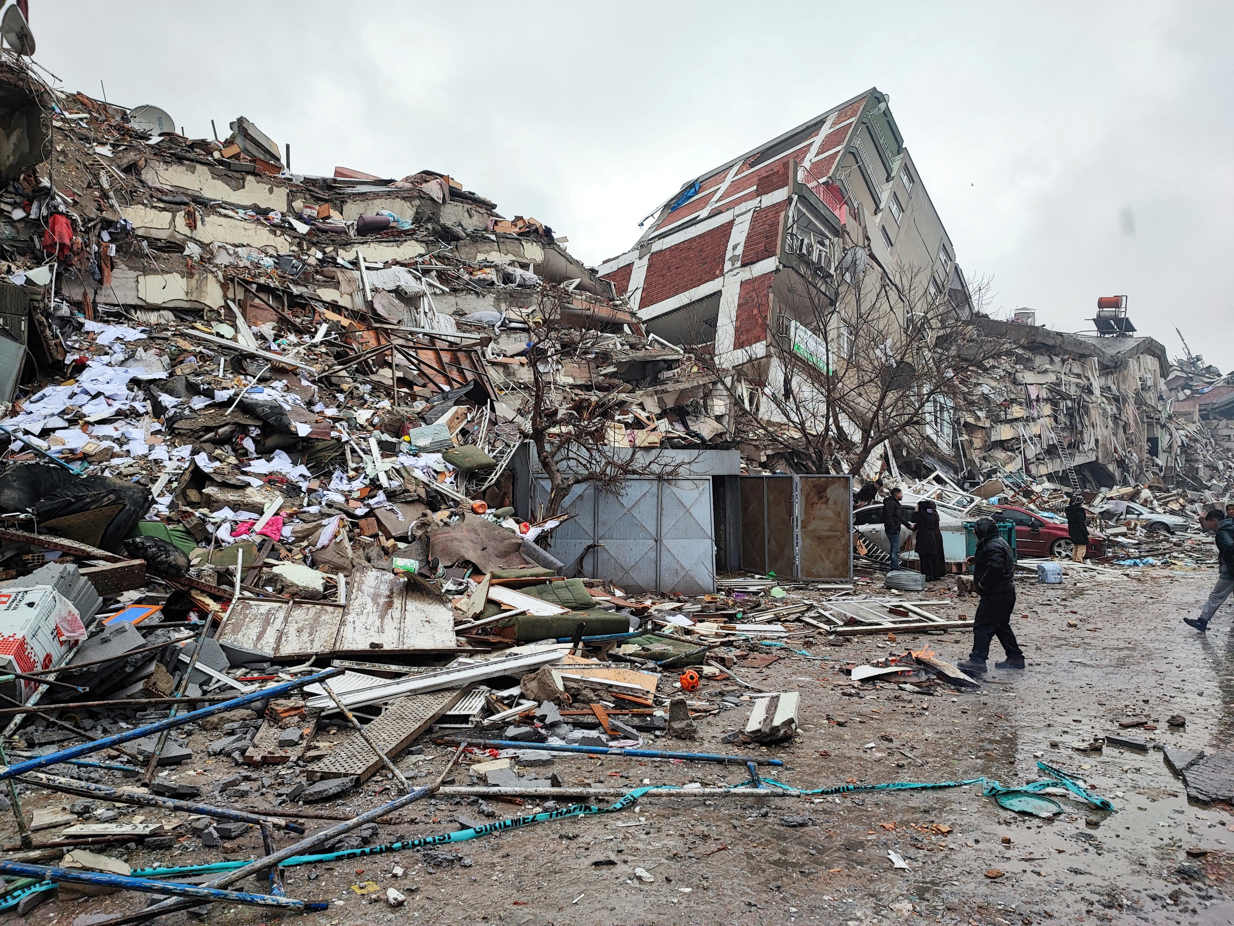
Pictures from near the epicentre in the Kahramanmaras province show huge piles of rubble and a building split in two.
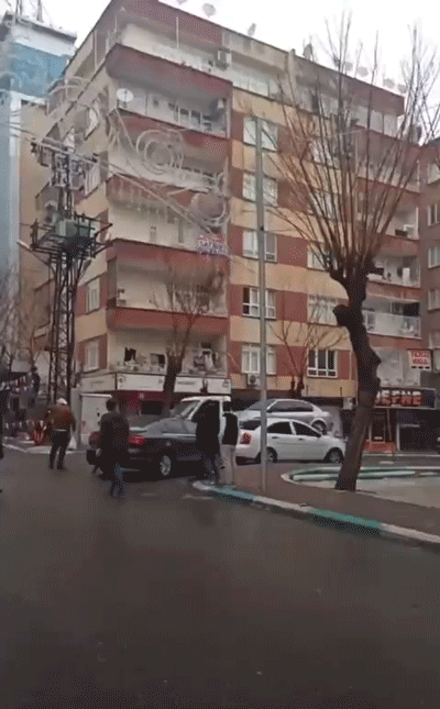
In the city of Sanliurfa, the moment a building collapsed was captured by a pedestrian.
Diyarbakir was further away from the source of the 7.8 magnitude quake but still saw significant destruction, with rescuers sorting through the rubble in an attempt to save any people trapped underneath.
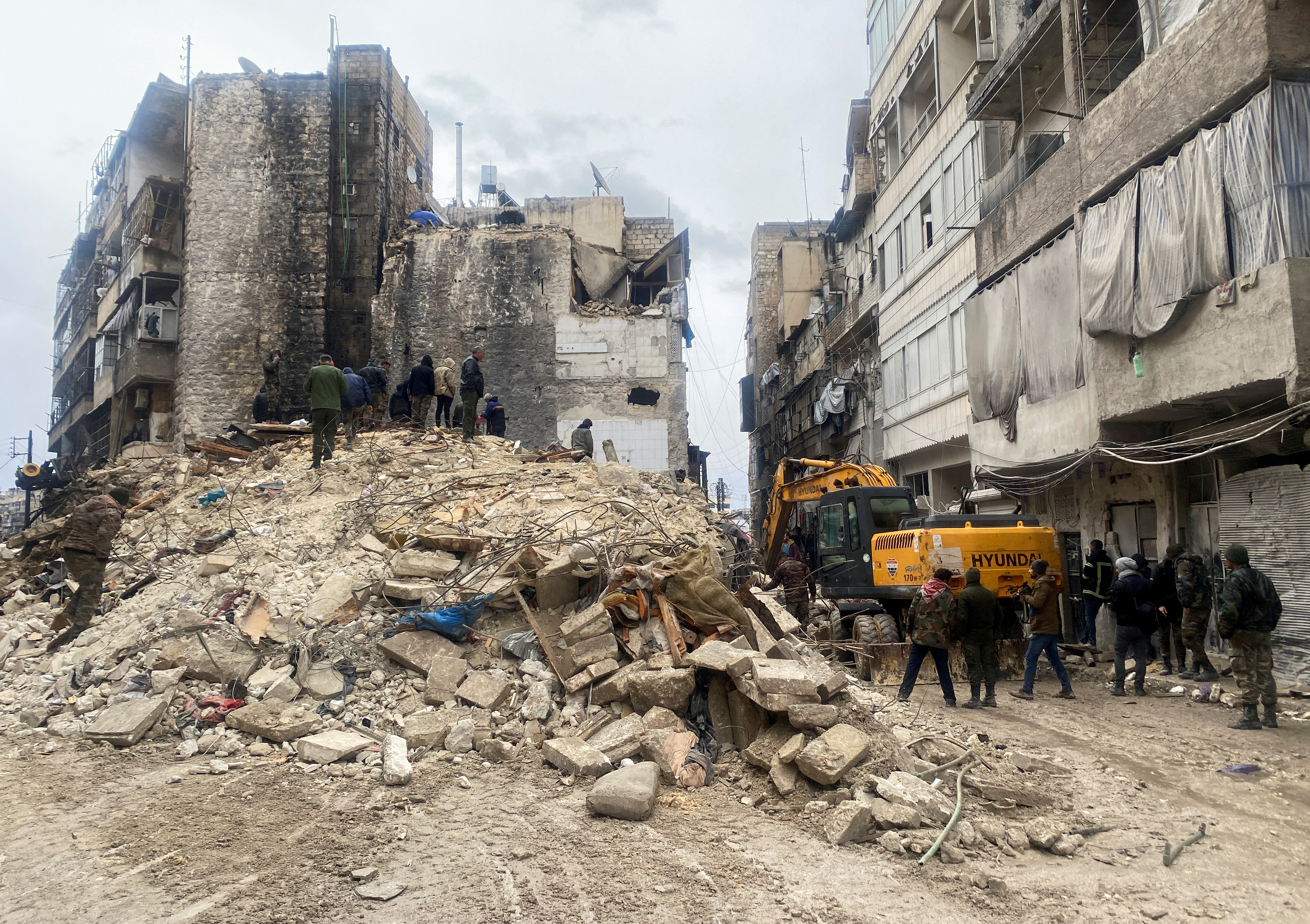
Substantial damage was also seen over the border in Syria, as shown in this photo from Aleppo.
While Turkey is in one of the world’s most active areas for earthquakes, Monday’s seismic activity has resulted in what the country’s president has said is the worst disaster to hit the region in decades.
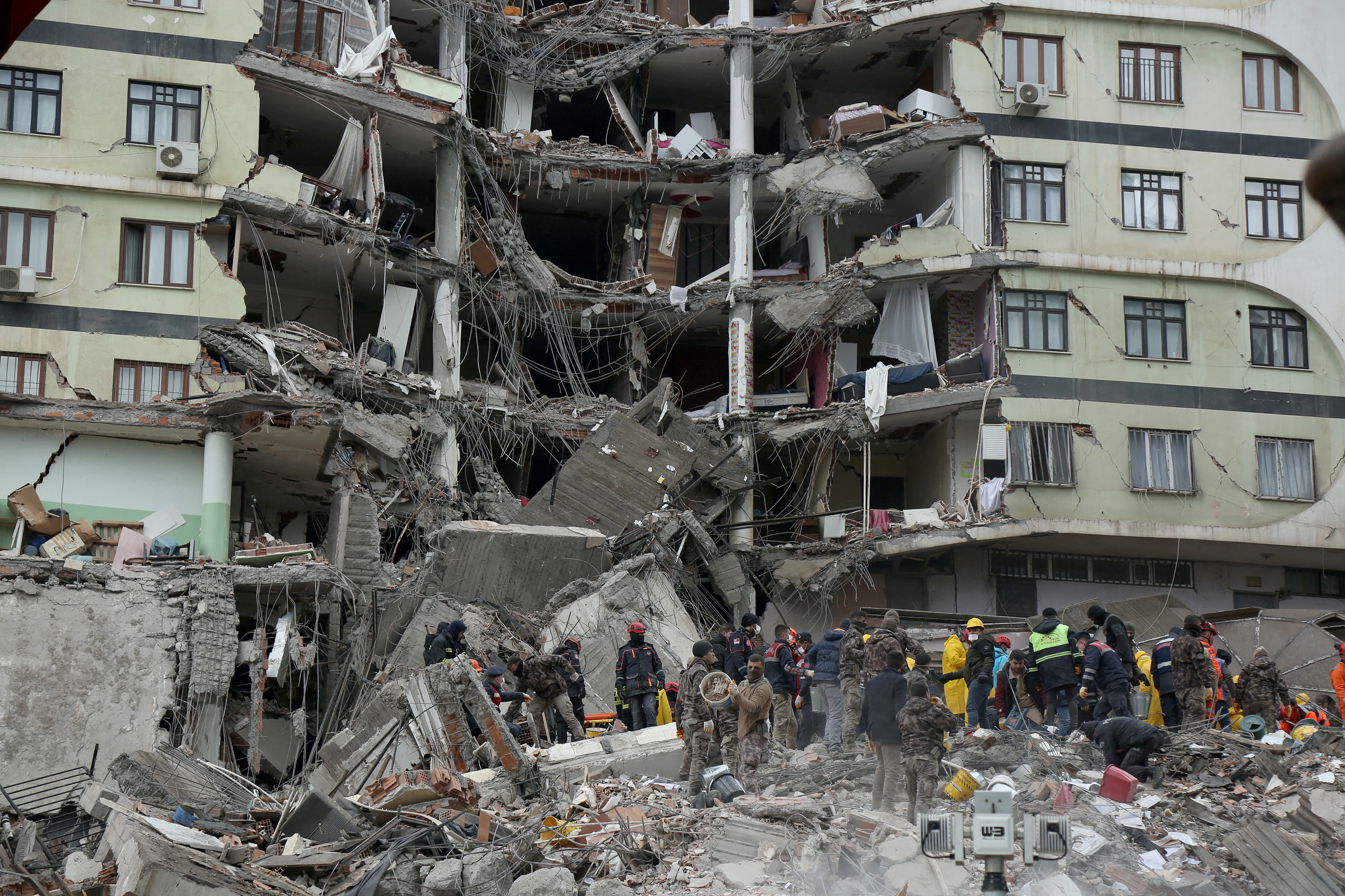
Rescue services have been digging through rubble, metal and concrete for survivors since the first earthquake struck.
Desperate relatives and friends of victims have been posting locations where extra help is needed to rescue those who are trapped underneath collapsed buildings.
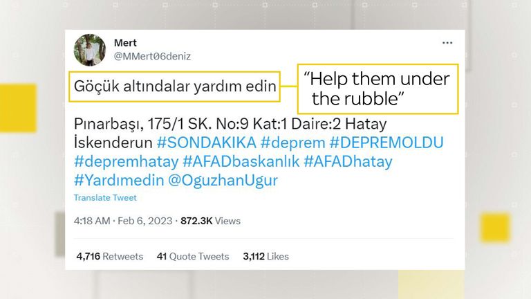
Social media users have been trying to get help to areas where people are still trapped
Others commenting on social media in Turkish are speculating whether poor construction materials and practices have contributed to how many buildings have been destroyed during this disaster.
Syria’s White Helmets rescue group has been sharing footage of their attempts to rescue those buried under rubble across the border.
The group operates in rebel-controlled areas of north-western Syria, an area home to around four million people displaced from other parts of the country by civil war.
Many of the residents live in buildings already wrecked from past bombardments, with the White Helmets commenting that now hundreds of families are trapped in rubble.
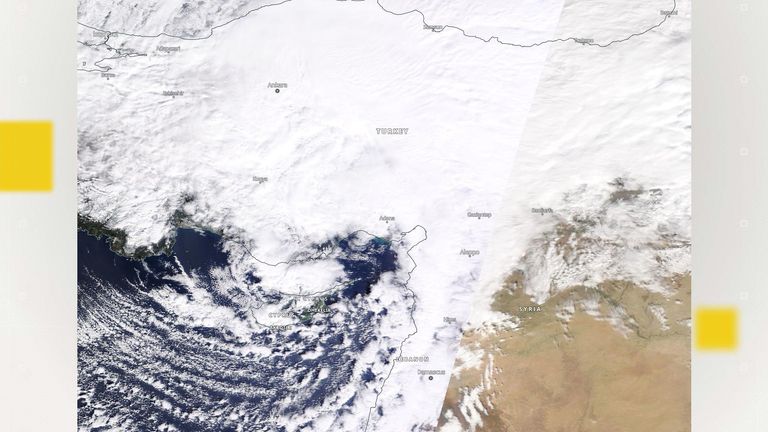
Heavy cloud cover across the area can be seen in this satellite image from NASA Worldview
With thick cloud covering the region as seen in this satellite image, rescue efforts have also been hampered by poor weather conditions, including rain and snow on the ground in some areas. Heavy thunderstorms, severe winds and snow are forecast in the coming days.
Official offers of help from countries around the world, as well as support from charities and aid organisations, have been extended to both Turkey and Syria as their citizens grapple with this disaster.
The Data and Forensics team is a multi-skilled unit dedicated to providing transparent journalism from Sky News. We gather, analyse and visualise data to tell data-driven stories. We combine traditional reporting skills with advanced analysis of satellite images, social media and other open source information. Through multimedia storytelling we aim to better explain the world while also showing how our journalism is done.
Why data journalism matters to Sky News


